Trending
NASA-ISRO collaborative satellite NISAR set for launch; know how it will track Earth’s every move
.png)
3 min read | Updated on July 30, 2025, 13:58 IST


SUMMARY
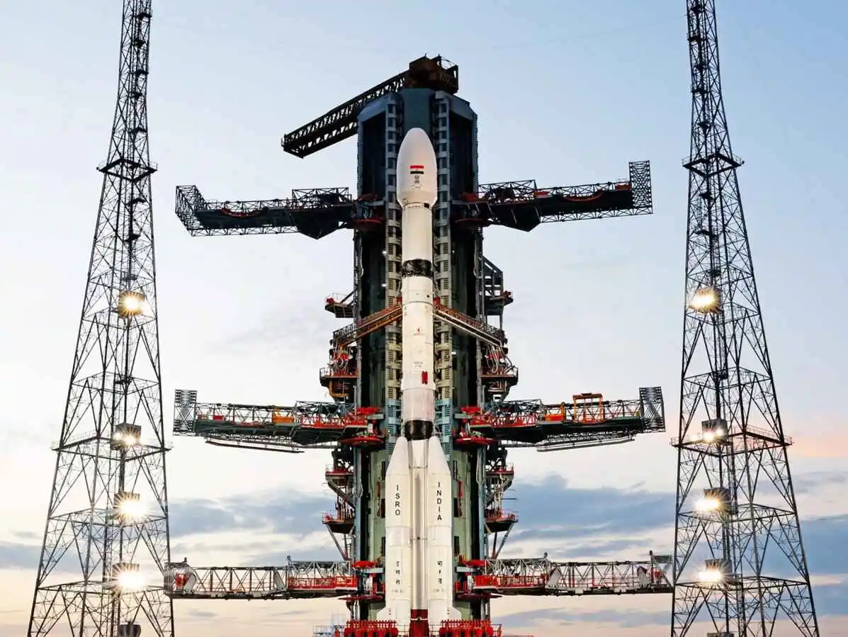
NISAR mission: Scheduled for liftoff on Wednesday at 5:40 pm IST from Sriharikota, the satellite will be carried into a polar orbit by a GSLV rocket.
NISAR satellite NASA ISRO.webp
India is set to launch a first-of-its-kind Earth observation satellite jointly developed by the Indian Space Research Organisation (ISRO) and the United States' National Aeronautics and Space Administration (NASA) on Wednesday.
The NASA-ISRO Synthetic Aperture Radar (NISAR) mission is designed to monitor Earth's land and ice surfaces with unprecedented precision.
The 27.5-hour countdown began on Tuesday ahead of the scheduled liftoff at 5:40 pm IST on Wednesday from Satish Dhawan Space Centre in Sriharikota.
The Geosynchronous Satellite Launch Vehicle (GSLV) will carry the satellite into a Sun-synchronous polar orbit. Typically, India’s PSLV (Polar Satellite Launch Vehicle) is used for such orbits but NISAR's mass exceeds PSLV’s capacity.
The 51.7-meter-tall, three-stage rocket will lift off from the second launch pad.
After undertaking a 19 minute journey post launch, the satellite is expected to be placed into its designated orbit at an altitude of 740km.
What is NISAR?
Developed over a decade by ISRO and NASA’s Jet Propulsion Laboratory, NISAR is the world’s first dual-frequency radar imaging satellite, equipped with L-band radar from NASA and S-band radar from ISRO.
The radars are sensitive to different surface features, including soil moisture, vegetation, and surface motion.
“NISAR mission’s primary objectives are to study land & ice deformation, land ecosystems, and oceanic regions in areas of common interest to the US and Indian science communities,” ISRO said in a statement.
The mission uses the SweepSAR technique, an advanced radar imaging method that delivers both high-resolution and wide-swath imagery. It means the satellite can capture highly detailed images of vast areas, every 12 days, under all weather conditions, day or night.
ISRO called the mission a “milestone of firsts,” noting it is the agency’s first Earth observation collaboration with NASA and the first GSLV mission to a polar orbit.
What will NISAR study?
The satellite’s data will help researchers monitor and understand land and ice deformation, including earthquakes and glacier movement; woody biomass and changes in forest cover; wetland dynamics and ecosystem changes; crop growth and extent; ice sheet changes in Greenland and Antarctica; mountain glacier retreat and sea ice drift; and land surface changes due to volcanoes, landslides, seismic activity, and groundwater depletion.
The observations will be essential for climate scientists, disaster management agencies, and policymakers across the globe.
K. Sivan, former ISRO chairperson, said that the satellite's sensitivity to surface changes, even as small as a centimetre, makes it ideal for pre-disaster risk assessments, reported The Indian Express.
However, it cannot directly predict events like floods or forest fires.
-
Launch Phase: GSLV lifts off with NISAR and places it into orbit.
-
Deployment Phase (Days 1–10): Includes full deployment of instruments and the unfolding of the large radar antenna.
-
Commissioning Phase (Days 11–90): Commissioning is divided into sub-phases of initial checks and calibrations of mainframe elements, followed by JPL engineering payload and instrument checkout.
-
Science Operations Phase (Post-Day 90): During this phase, the science orbit will be maintained via regular manoeuvres, scheduled to avoid or minimise conflicts with science observations.
NISAR will serve as a powerful global observatory, delivering valuable data for managing natural resources, responding to disasters, and understanding climate change impacts.
About The Author
Next Story