Business News
Google Maps gets a Gemini brain: Ask questions, get routes in immersive 3D
.png)
3 min read | Updated on March 13, 2026, 12:35 IST


SUMMARY
The update brings a conversational feature called “Ask Maps” and a redesigned navigation system with immersive 3D visuals.
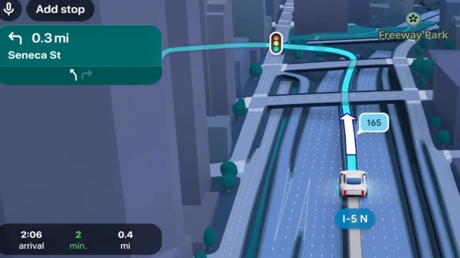
Google announced Immersive Navigation, which adds detailed 3D representations of roads, buildings and terrain to improve driving guidance.
Google on Thursday unveiled a major overhaul of Google Maps powered by its Gemini models, introducing a conversational feature called “Ask Maps” and a redesigned navigation interface with immersive 3D visuals.
“Today, Google Maps is fundamentally changing what a map can do,” said Miriam Daniel, vice president and general manager for Google Maps.
“By bringing together the world's freshest map with our most capable Gemini models, we’re transforming exploration into a simple conversation and making driving more intuitive than ever with our biggest navigation upgrade in over a decade,” she added.
The new Ask Maps feature allows users to ask complex, real-world questions directly within the app.
Instead of searching through reviews or multiple listings, users can ask questions conversationally.
“Now you can ask for things like, ‘My phone is dying — where can I charge it without having to wait in a long line for coffee?’ or ‘Is there a public tennis court with lights on that I can play at tonight?’” Daniel wrote in a blog post.
Google said the system analyses information from more than 300 million places globally and incorporates reviews from a community of over 500 million contributors to generate recommendations tailored to users’ preferences.
The feature has begun rolling out in the United States and India on Android and iOS devices.
Google is also introducing immersive navigation that adds detailed 3D visuals of roads, buildings and terrain to help drivers better anticipate turns and lane changes.
“We’re also launching Immersive Navigation - our biggest navigation upgrade in over a decade!,” Google CEO Sundar Pichai posted on X.
Google said the feature relies on Gemini models that analyse imagery from Street View and aerial photographs to create an accurate visual representation of roads and landmarks.
“But this is more than just a visual update,” Daniel said. “We’re also adding new functionality to make your drive as stress-free as possible.”
The company said Maps processes more than 5 million traffic updates every second globally and receives more than 10 million daily reports from drivers on disruptions such as crashes or construction.
Immersive Navigation will start rolling out in the United States on Thursday and expand over the coming months to eligible Android and iOS devices, Apple CarPlay, Android Auto and vehicles with Google built-in. “What a big improvement to Google maps!” one user wrote on X, while another said, “Google Maps just set Apple Maps back another 5 years.”
However, there were also questions about whether highly detailed visuals improve navigation.
One critic wrote that “the symbolic version of a map is better than 3D version for navigation,” arguing that detailed 3D graphics could slow down how quickly drivers process information on screen.
About The Author
Next Story